

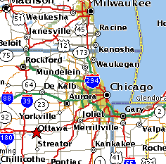
One bright Fall afternoon in 1998, my Champ and I were cruising along a few hundred feet above the Illinois River. At 80 MHP the towns passed slowly under our wings; Morris, Seneca, Marseilles, Ottawa. Ottawa! From out of nowhere an oft-read phrase flashed across my mind, "The sheriff from Ottawa arrived, and we took the mail to the Ottawa Post Office to be entrained at 3:30 A.M. for Chicago." It was, of course, Charles A. Lindbergh recounting an incident of some three quarters of a century ago now.
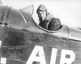
On a regular airmail flight from St. Louis to Chicago on the night of September 16, 1926, with his plane out of fuel and on top of a dense fogbank, the 24 year old pilot parachuted to safety into a cornfield. His stricken plane, a DH-4B, crashed a short distance away.
|
As a ten year old boy at the time of his Paris flight, I never quite lost my interest in this man and his life. Here I was, eighty two years old, a pilot myself, flying over the same area where the incident occurred. When one flies a Champ he gets to see a lot of the countryside. There were cornfields everywhere but where did this actually happen?
Since I frequently fly over and land at many of the small airfields that dot the area I never missed an opportunity to question local pilots, especially the older ones like myself, for any information they might have regarding the incident. While some had heard about it only one came up with a fruitful suggestion; had I talked with the people at the LaSalle County Historical Society? I had finally struck paydirt.
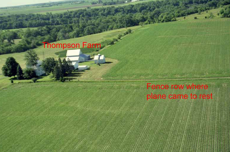
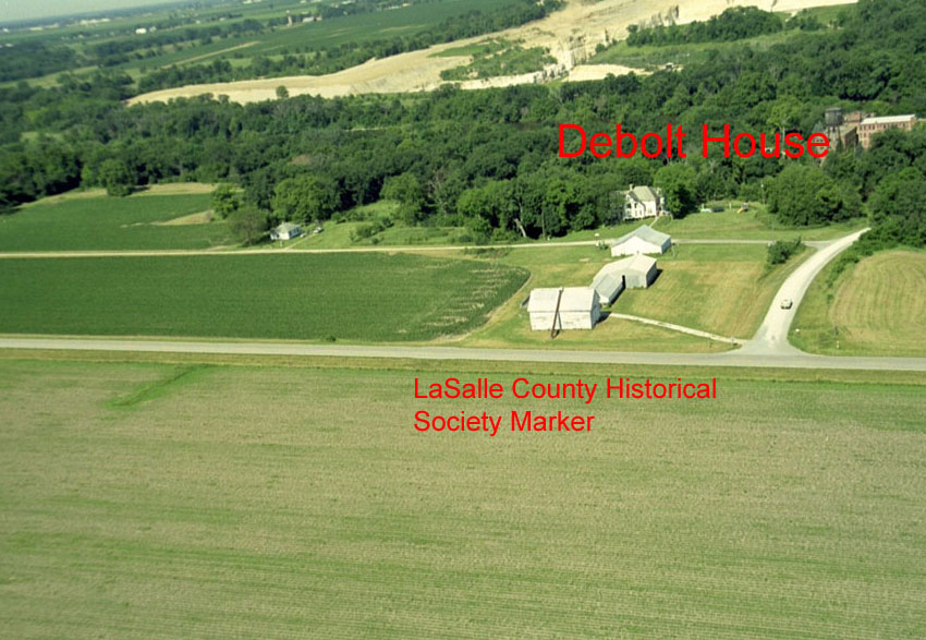
A call to their office in Utica, IL in July, 1999, put me in touch with one of their directors, a Mrs. Mary G. Small. She turned out to be an absolute angel. Not only was she a lifelong resident of the area but had first hand knowledge of the incident. She placed it near Wedron in Rutland Twp. It was not long before she was caught up in the spirit of my quest. She and her husband, Davis, drove up to the area and started questioning residents. They located a Mr. Russell Thompson living on what had been his father's farm where the pilotless plane crashed. While he was only seven years old at the time he was able to point out the field where Lindbergh alit as well as the DeBolt home where he spent the night and the fence row where the plane came to rest, both still standing. Davis did such a fine job of marking up a plat map that I had no trouble in locating the area and its features from the air and getting some excellent air to ground photos.
|
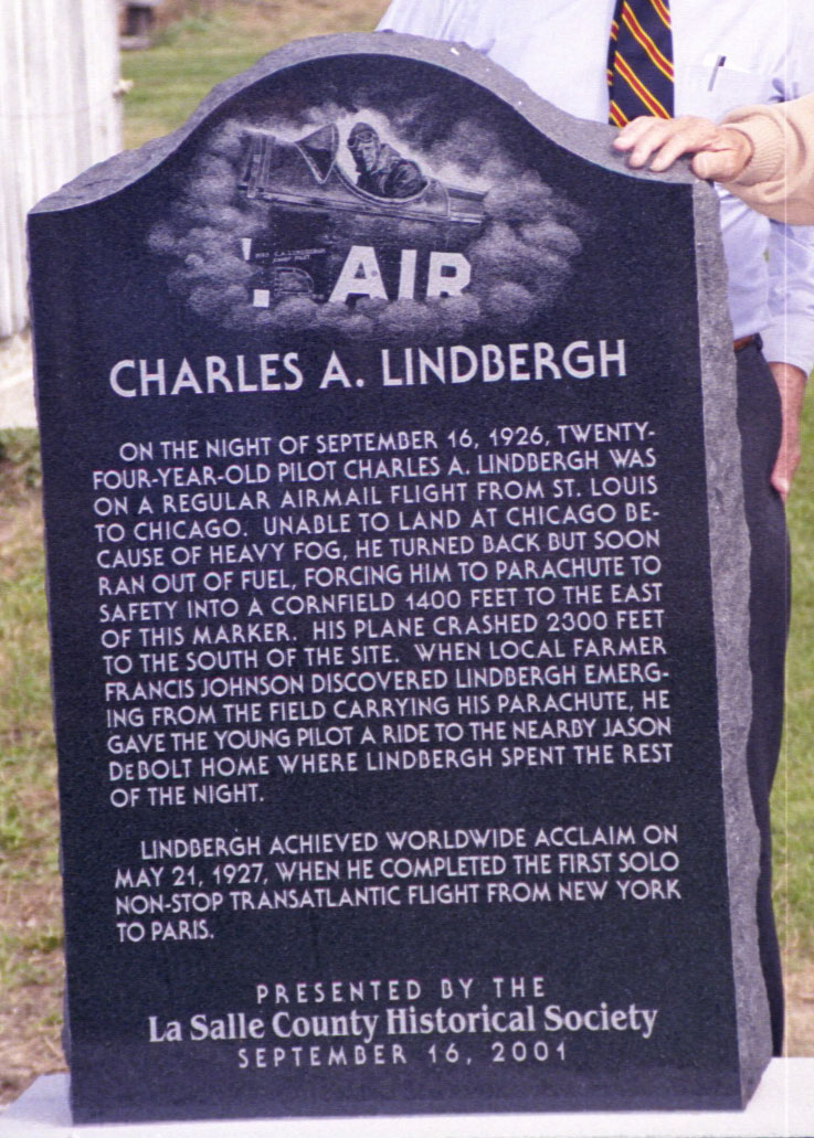
While my quest has been successfully complete, the story does not end here. At some point in our endeavour Mary and I came up with the thought that this incident in LaSalle County history should not go unrecognized "before the memories fade." We felt that a simple stone marker, suitably inscribed, should be placed near the site. She presented this proposal to the Board of the LaSalle County Historical Society which in turn agreed to sponsor the project. The DeBolt heirs agreed to the placement of the marker on their property and, the fund -raising being essentially complete, an order was placed for it in March.
The dedication took place under a clear blue sky, on Sunday, September 16, 2001, exactly 75 years to the day of the incident. Among the attendees were two very special people. Arlene Johnson Bastian had been in the car with her parents that night when Lindbergh emerged from the cornfield carrying his parachute. (For his account of the encounter start on page 7 in Spirit of St. Louis.) She has total recall of the event. The other was Russell Thompson who was awakened from his sleep by the sound of the pilotless DH-4 crashing through his father's fencerow barely 100 yards from his bedroom. CAL's description of the scene on page 9 in Spirit of St. Louis. is borne out by Mr. Thompson. Although he is now totally blind the incident is still clear in his mind. The marker and its inscription are a fitting testimony to this bit of history
View LaSalle County Historical Society Crash Site Marker
Click on the thumbnail image below to view a high resolution picture of the crash site marker:
|
View pictures of crash site
Click on the thumbnail images below to view a high resolution picture of the DH-4 crash site and parachute landing area.
 |
 |
Privacy Policy | Terms and Conditions | This site is not affiliated with the Lindbergh family,
Lindbergh Foundation, or any other organization or group.
This site owned and operated by the Spirit of St. Louis 2 Project.
Email: webmaster@charleslindbergh.com
® Copyright 2014 CharlesLindbergh.com®, All rights reserved.
Help support this site, order your www.Amazon.com materials through this link.
